


Clara Verner Towers, Tuscaloosa County, Alabama
About
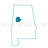
Outline

Summary
| Unique Area Identifier | 523015 |
| Name | Clara Verner Towers |
| County | Tuscaloosa County |
| State | Alabama |
| Area (square miles) | 2.34 |
| Land Area (square miles) | 2.17 |
| Water Area (square miles) | 0.17 |
| % of Land Area | 92.82 |
| % of Water Area | 7.18 |
| Latitude of the Internal Point | 33.21496300 |
| Longtitude of the Internal Point | -87.53988030 |
Maps


Graphs
Select a template below for downloading or customizing gragh for Clara Verner Towers, Tuscaloosa County, Alabama


Neighbors
Neighoring Voting District (by Name) Neighboring Voting District on the Map
- County Courthouse, Tuscaloosa County, AL
- Forest Lake Methodist Church, Tuscaloosa County, AL
- Holt Armory, Tuscaloosa County, AL
- Jayces Park, Tuscaloosa County, AL
- Reg Education Center, Tuscaloosa County, AL
- Tuscaloosa Academy-Wood Village, Tuscaloosa County, AL
- University Mall, Tuscaloosa County, AL
Top 10 Neighboring County Subdivision (by Population) Neighboring County Subdivision on the Map
Top 10 Neighboring Place (by Population) Neighboring Place on the Map
Top 10 Neighboring Unified School District (by Population) Neighboring Unified School District on the Map
Top 10 Neighboring State Legislative District Lower Chamber (by Population) Neighboring State Legislative District Lower Chamber on the Map
Top 10 Neighboring State Legislative District Upper Chamber (by Population) Neighboring State Legislative District Upper Chamber on the Map
Top 10 Neighboring 111th Congressional District (by Population) Neighboring 111th Congressional District on the Map
Top 10 Neighboring Census Tract (by Population) Neighboring Census Tract on the Map
- Census Tract 112, Tuscaloosa County, AL (7,031)
- Census Tract 104.06, Tuscaloosa County, AL (4,219)
- Census Tract 114.01, Tuscaloosa County, AL (3,769)
- Census Tract 104.07, Tuscaloosa County, AL (3,665)
- Census Tract 114.02, Tuscaloosa County, AL (3,525)
- Census Tract 126, Tuscaloosa County, AL (2,876)
- Census Tract 116, Tuscaloosa County, AL (2,844)
- Census Tract 104.04, Tuscaloosa County, AL (2,497)